Maps of the Hauraki Plains
- 15 February 2025
Sourced from Auckland Libraries Heritage Collections.

topographical map of the area around Mangatawhiri in the Waikato. Includes the south-eastern part of the Hunua Ranges, Maramarua, Waitakaruru, Pipiroa, Kaiaua, Miranda. Heritage Collections Map 9311
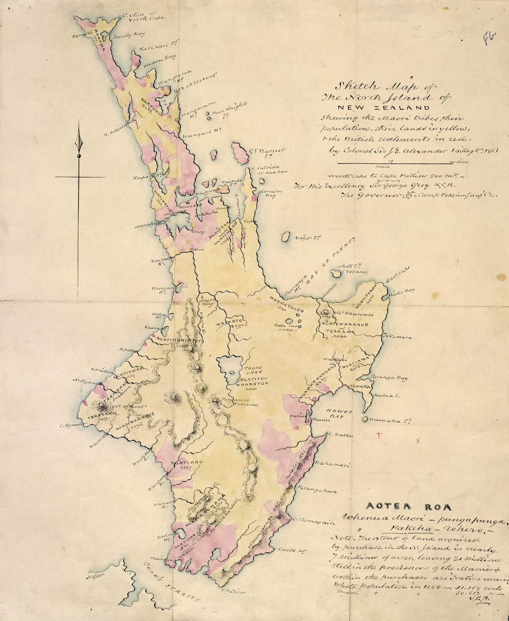
Sketch map of the North Island of New Zealand shewing the Maori tribes, their population, their lands in yellow & the British settlements in red. produced 'for His Excellency Sir George Grey. Map 2563
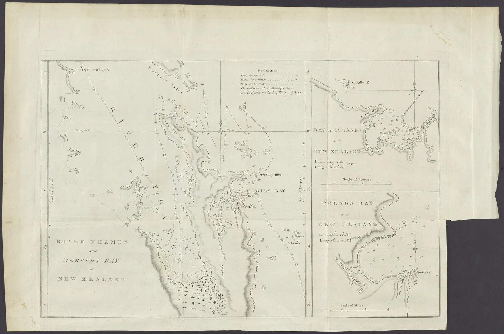
River Thames and Mercury Bay in New Zealand 1773
![Map with photographs showing the transformation of the Piako Swamp. [New Zealand Graphic 1909-10-06 Record ID NZG-19091006-0020-01]](https://cdn-asset-mel-2.airsquare.com/jodalgety/managed/image/widget/image_gallery/AA90AD6F-1CC4-410F-8C9E380E30505F73-2000w.webp)
Map with photographs showing the transformation of the Piako Swamp. [New Zealand Graphic 1909-10-06 Record ID NZG-19091006-0020-01]

27/4/1909 Section 1 to 16 Wharekawa S.D. www.premise.co.nz #15909
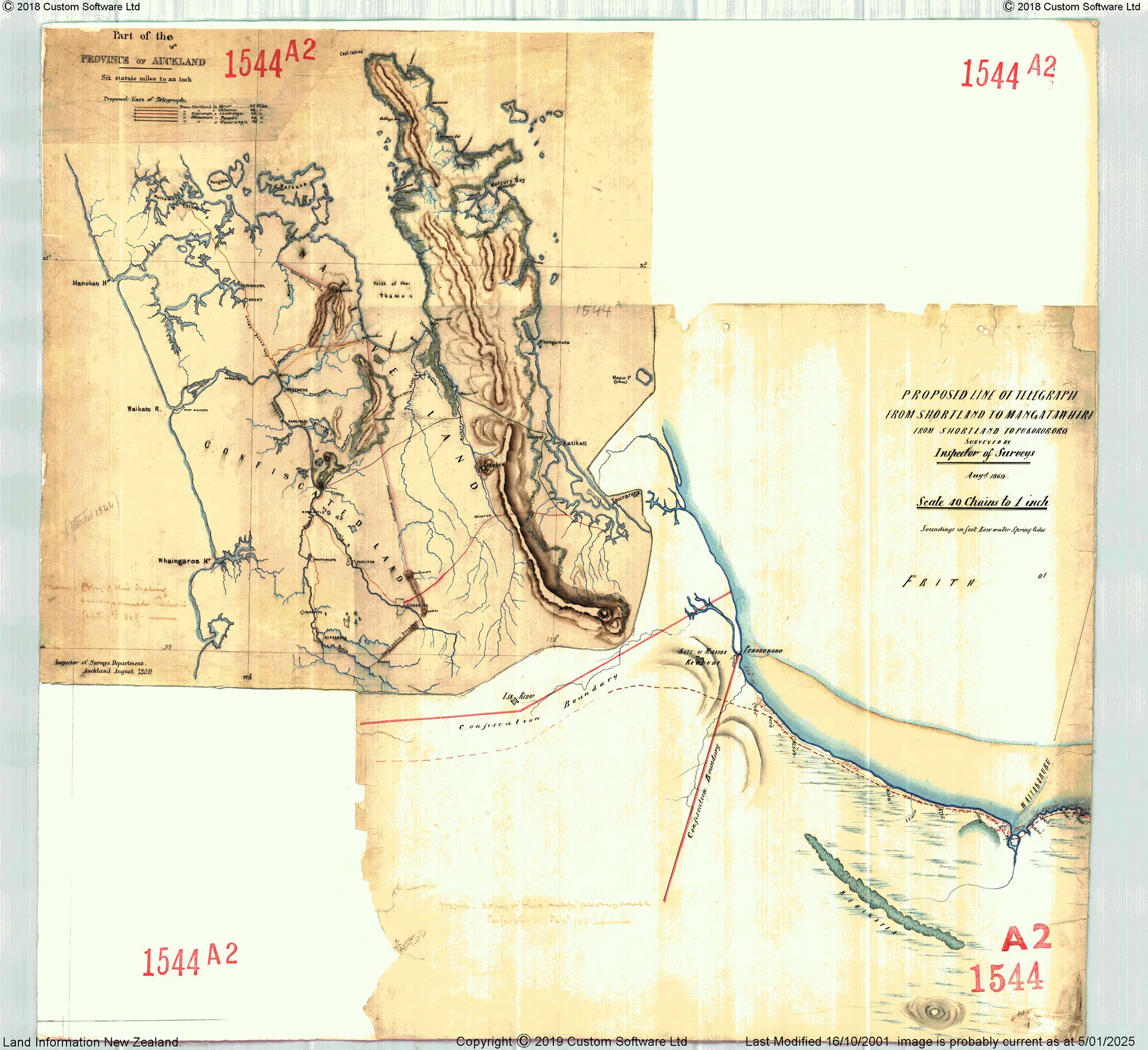
Proposed Line of Telegragh from Shortland to Pukorokoro Aug 1869 www.premise.co.nz #A21544
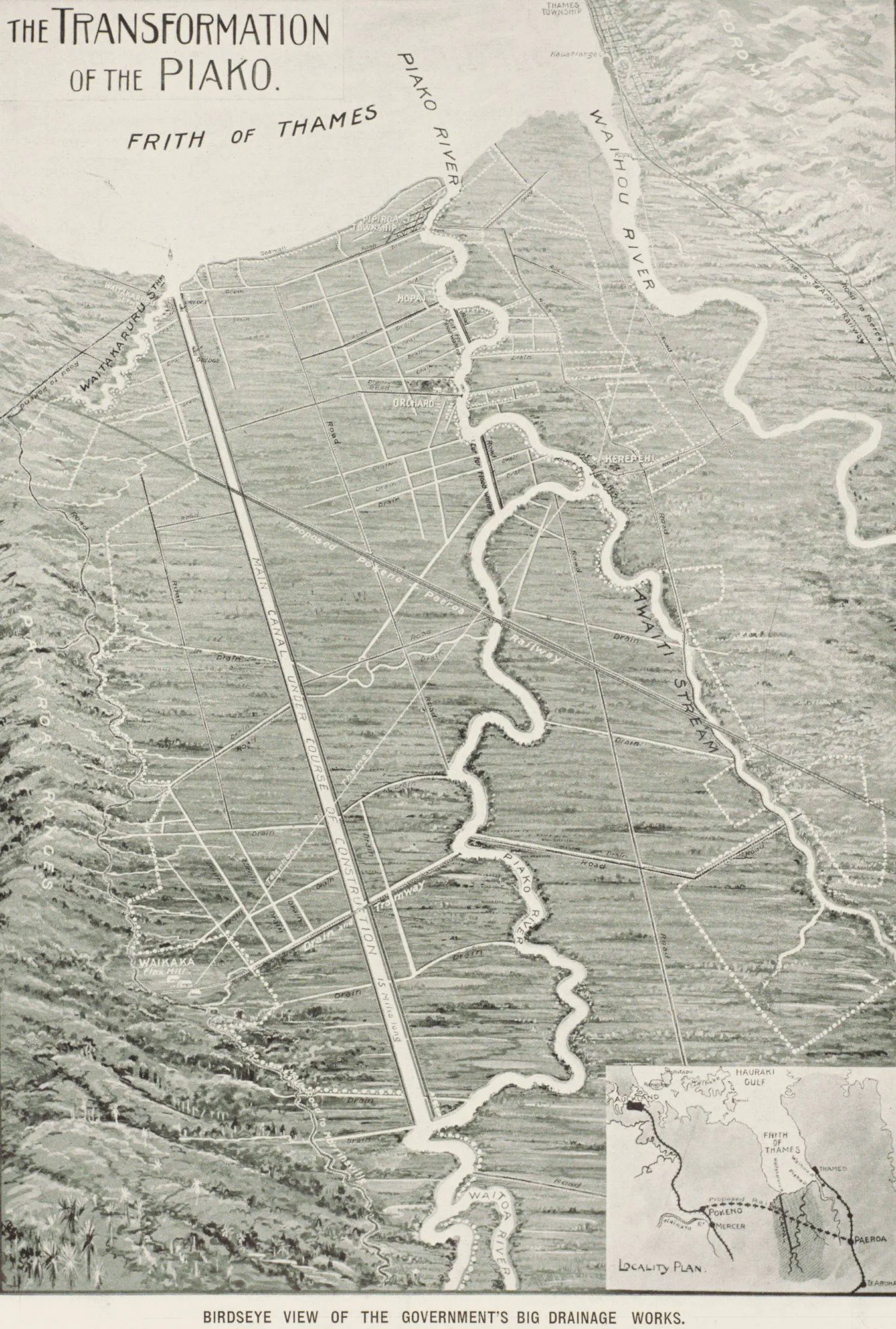
Birdseye view of the government's big drainage works round the Piako River and the Piako Swamp. NZ Graphic 1910-02-09. NZG-19100209-0017-01
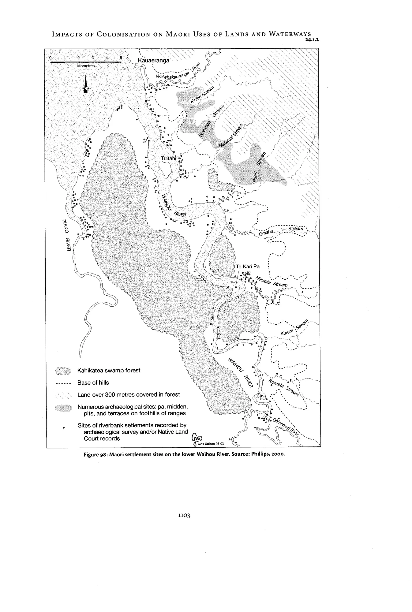
Impacts of Colonization on Maori Uses of Lands and Waterways